
- Start >
- Rivers >
- Waterlevel >
- Naab - Regen >
- Schwabelweis >
- Chart of month

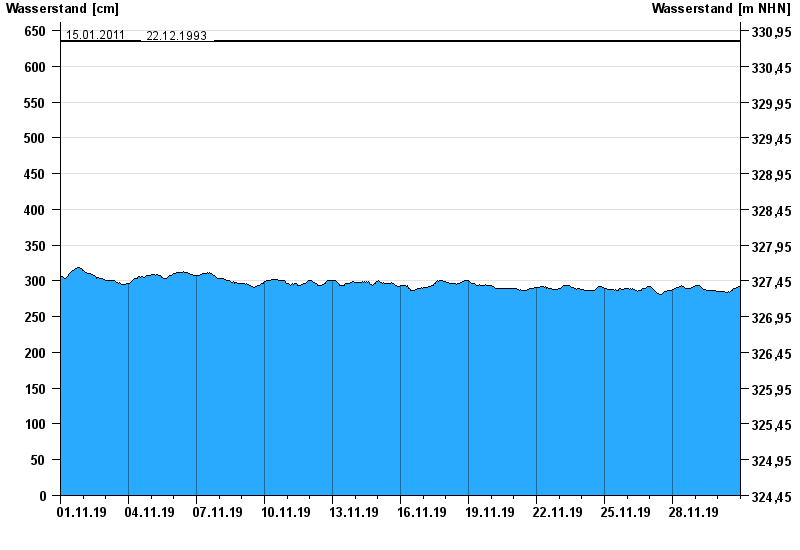
Chart of month Schwabelweis / Donau
Waterlevel from 01.11.2019 to 30.11.2019
- 04.06.2013 Wasserstand: 693 cm
- 28.03.1988 Wasserstand: 672 cm
- 14.08.2002 Wasserstand: 663 cm
- 15.01.2011 Wasserstand: 636 cm
- 22.12.1993 Wasserstand: 634 cm
| Date | Waterlevel [cm] |
|---|---|
| 30.11.2019 23:45 | 293 |
| 30.11.2019 23:30 | 293 |
| 30.11.2019 23:15 | 292 |
| 30.11.2019 23:00 | 292 |
| 30.11.2019 22:45 | 292 |
| 30.11.2019 22:30 | 292 |
| 30.11.2019 22:15 | 292 |
© Bayerisches Landesamt für Umwelt 2024