
- Start >
- Rivers >
- Waterlevel >
- Untere Donau >
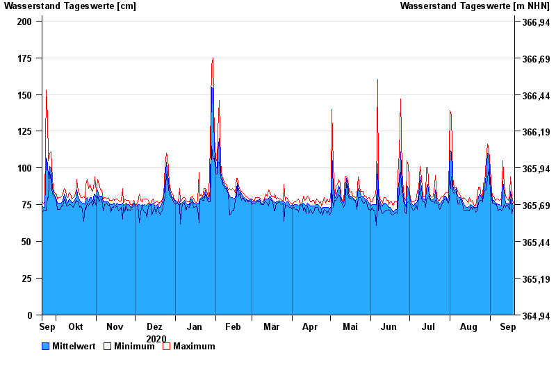
- Grafentraubach >
- Chart of year

Chart of year Grafentraubach / Kleine Laber
Waterlevel from 20.09.2020 to 19.09.2021
- Hochwassergefahrenfläche HQ100 250 cm
- Hochwassergefahrenfläche HQhäufig 220 cm
| Date | Mean value [cm] | Maximum [cm] | Minimum [cm] |
|---|---|---|---|
| 19.09.2021 | 74 | 76 | 73 |
| 18.09.2021 | 77 | 81 | 69 |
| 17.09.2021 | 84 | 94 | 79 |
| 16.09.2021 | 77 | 83 | 72 |
| 15.09.2021 | 75 | 78 | 73 |
| 14.09.2021 | 76 | 79 | 75 |
| 13.09.2021 | 76 | 81 | 73 |
© Bayerisches Landesamt für Umwelt 2024