
- Start >
- Rivers >
- Waterlevel >
- Untere Donau >
- Landau >
- Chart of year

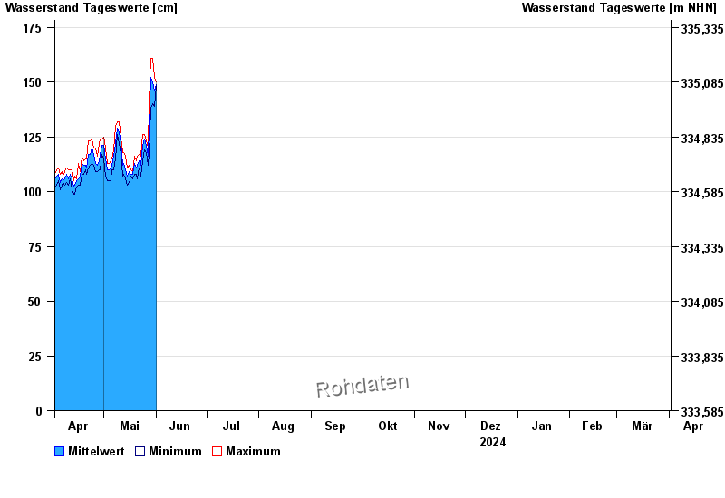
Chart of year Landau / Isar
Waterlevel from 02.04.2024 to 01.04.2025
- 04.06.2013 Wasserstand: 495 cm
- 19.06.1979 Wasserstand: 485 cm
- 24.05.1999 Wasserstand: 467 cm
- 25.08.2005 Wasserstand: 462 cm
- 23.07.1981 Wasserstand: 411 cm
| Date | Mean value [cm] | Maximum [cm] | Minimum [cm] |
|---|---|---|---|
| 26.12.2024 | 106 | 109 | 104 |
| 25.12.2024 | 110 | 114 | 104 |
| 24.12.2024 | 113 | 117 | 108 |
| 23.12.2024 | 121 | 130 | 113 |
| 22.12.2024 | 108 | 118 | 104 |
| 21.12.2024 | 103 | 105 | 100 |
| 20.12.2024 | 103 | 107 | 100 |
© Bayerisches Landesamt für Umwelt 2024