
- Start >
- Rivers >
- Waterlevel >
- Untere Donau >
- Mühldorf >
- Chart of year

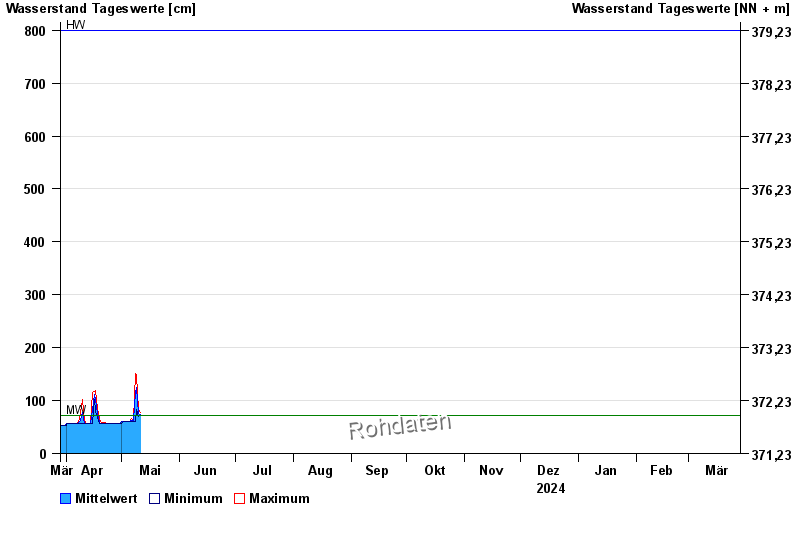
Chart of year Mühldorf / Inn
Waterlevel from 29.03.2024 to 28.03.2025
| Date | Mean value [cm] | Maximum [cm] | Minimum [cm] |
|---|---|---|---|
| 12.07.2024 | 246 | 273 | 230 |
| 11.07.2024 | 257 | 294 | 219 |
| 10.07.2024 | 222 | 258 | 192 |
| 09.07.2024 | 241 | 272 | 224 |
| 08.07.2024 | 307 | 337 | 270 |
| 07.07.2024 | 187 | 281 | 161 |
| 06.07.2024 | 152 | 179 | 121 |
© Bayerisches Landesamt für Umwelt 2024