
- Start >
- Rivers >
- Waterlevel >
- Untere Donau >
- Plattling >
- Chart of month

Chart of month Plattling / Isar
Waterlevel from 04.07.2023 to 03.08.2023
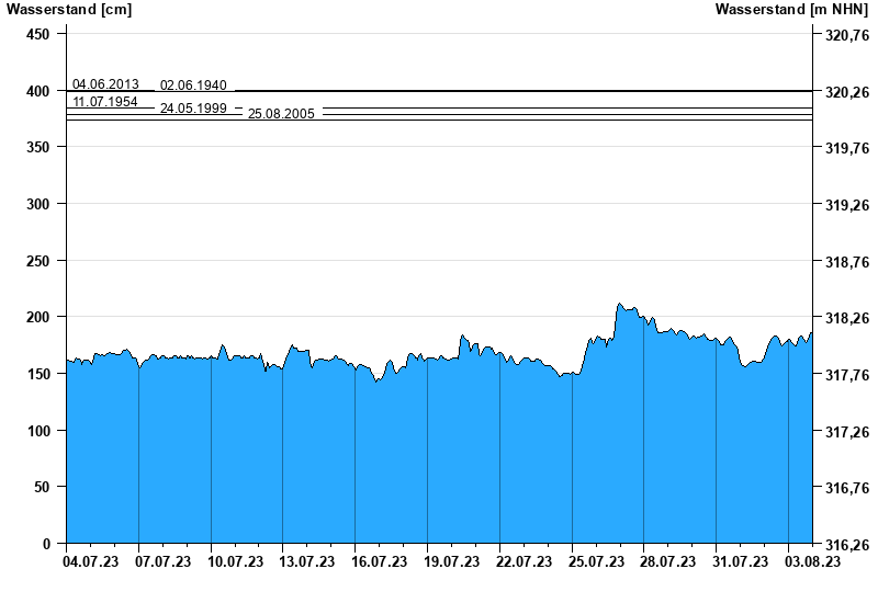
- 04.06.2013 Wasserstand: 400 cm
- 02.06.1940 Wasserstand: 399 cm
- 11.07.1954 Wasserstand: 384 cm
- 24.05.1999 Wasserstand: 378 cm
- 25.08.2005 Wasserstand: 374 cm
| Date | Waterlevel [cm] |
|---|---|
| 04.08.2023 00:45 | 185 |
| 04.08.2023 00:30 | 185 |
| 04.08.2023 00:15 | 185 |
| 04.08.2023 00:00 | 186 |
| 03.08.2023 23:45 | 186 |
| 03.08.2023 23:30 | 186 |
| 03.08.2023 23:15 | 186 |
© Bayerisches Landesamt für Umwelt 2024