
- Start >
- Rivers >
- Waterlevel >
- Untere Donau >
- Pulling >
- Chart of month

Chart of month Pulling / Regen
Waterlevel from 22.11.2023 to 21.12.2023
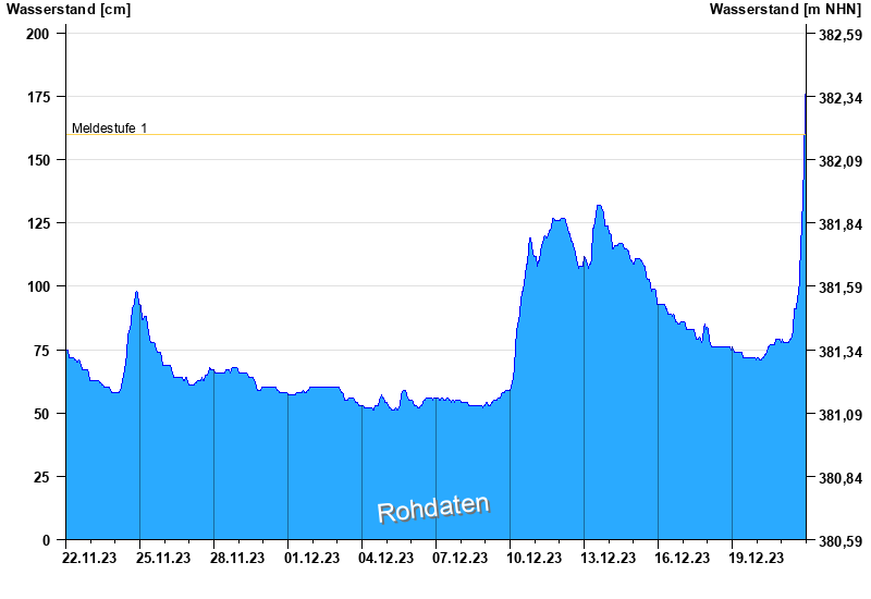
- Meldestufe 1 160 cm
- Meldestufe 2 230 cm
- Meldestufe 3 280 cm
- Meldestufe 4 320 cm
- Hochwassergefahrenfläche HQ100 380 cm
| Date | Waterlevel [cm] |
|---|---|
| 21.12.2023 23:45 | 179 |
| 21.12.2023 23:30 | 177 |
| 21.12.2023 23:15 | 173 |
| 21.12.2023 23:00 | 163 |
| 21.12.2023 22:45 | 154 |
| 21.12.2023 22:30 | 148 |
| 21.12.2023 22:15 | 147 |
© Bayerisches Landesamt für Umwelt 2025