
- Start >
- Rivers >
- Waterlevel >
- Regnitz >
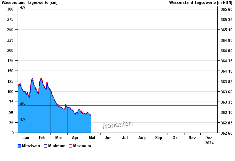
- Beilngries oberh. der Sulz >
- Chart of year

Chart of year Beilngries oberh. der Sulz / Altmühl
Waterlevel from 01.01.2024 to 31.12.2024
| Date | Mean value [cm] | Maximum [cm] | Minimum [cm] |
|---|---|---|---|
| 15.10.2024 | 85 | 94 | 73 |
| 14.10.2024 | 65 | 75 | 63 |
| 13.10.2024 | 65 | 66 | 64 |
| 12.10.2024 | 66 | 67 | 66 |
| 11.10.2024 | 69 | 70 | 67 |
| 10.10.2024 | 71 | 71 | 70 |
| 09.10.2024 | 69 | 70 | 68 |
© Bayerisches Landesamt für Umwelt 2024